|
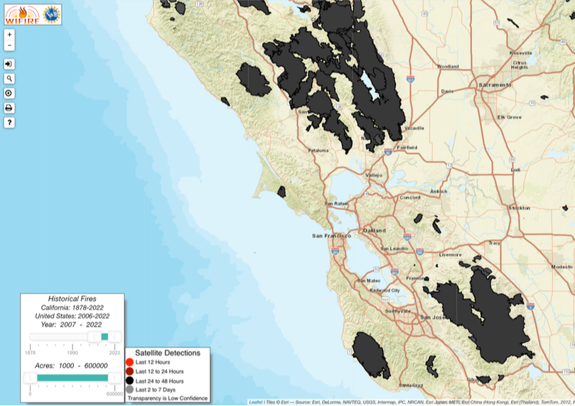
Fire HistoryWIFIRE Firemap: https://firemap.sdsc.edu/
Do you know the last time your region burned? Use the interactive map at the link above to explore over 100 years of fire history. The map also tracks active wildfires in real time. |

|
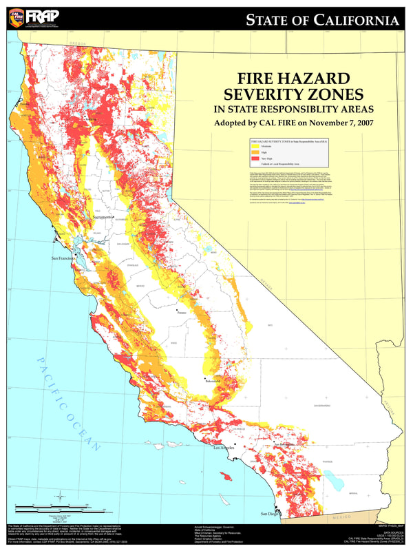
Fire Hazard Severity Zoneshttps://egis.fire.ca.gov/FHSZ/
Fire Hazard Maps by county These maps are developed by the State Fire Marshall to model where severe wildfire is most likely to occur. They are used to help determine defensible space standards and building codes at the local level, and may factor into real estate disclosures and insurance risk. These maps are broken down by the three types of responsibility areas in the state - meaning which organization is responsible for the prevention and suppression of wildfire. These are Federal Responsibility Areas (FRA), State Responsibility Areas (SRA, ie Cal Fire), and Local Responsibility Areas (LRA, ie municipalities). Learn your own property’s hazard level and who is responsible for its protection from wildfire with the links above. |